
Site Control KMZ File
£50.00 Excl VAT.
See your Site Control Points in Google Earth or Maps. Have a KMZ file produced for use in Google Earth from your Site Control Points.
In stock
Description
See your Site Control Points in Google Earth or Maps. This is a conversion service for your National Grid Control Points into a KMZ file for Google Earth.
Finding control station points on a new construction site can be tricky. Make your life easier with this conversion service of your site control points (National Grid Eastings, Northings and Elevations) into a KMZ file that can be viewed in Google Earth.
How this service works.
Purchase the service and send your list of control stations to us.
Provide some additional information like the nearest town or place to help locate your points.
We will convert your list of control stations and email you a kmz file that can be opened with Google Earth.
Make sure that you are happy the file and the control station positions.
[/x_tab] [x_tab class="reviews_pane"]
Only logged in customers who have purchased this product may leave a review.
Related products
-
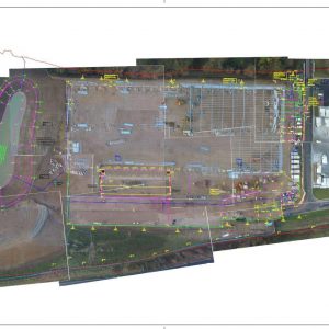
AutoCAD Drawing Overlay
£100.00 Excl VAT. Add to basket -
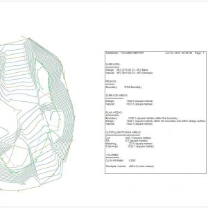
Stockpile Volume Calculation
£50.00 Excl VAT. Add to basket
Reviews
There are no reviews yet.